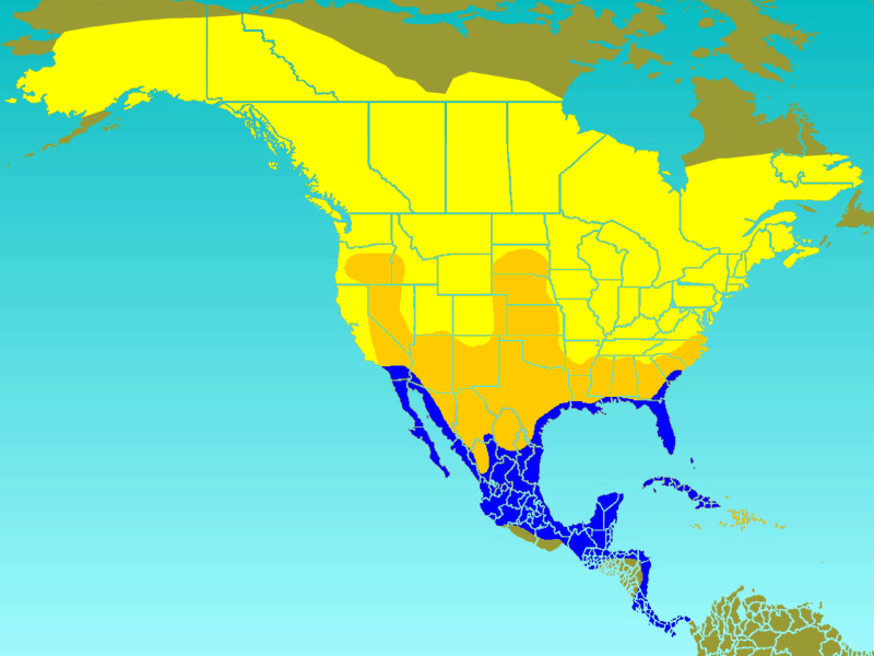
Fil:Tree Swallow-rangemap.gif
Tree_Swallow-rangemap.gif (800 × 600 pixlar, filstorlek: 55 kbyte, MIME-typ: image/gif)
Filhistorik
Klicka på ett datum/klockslag för att se filen som den såg ut då.
| Datum/Tid | Miniatyrbild | Dimensioner | Användare | Kommentar | |
|---|---|---|---|---|---|
| nuvarande | 11 juni 2008 kl. 14.02 |  | 800 × 600 (55 kbyte) | Ken Thomas | {{Information |Description=Approximate range/distribution map of the Tree Swallow (''Tachycineta bicolor''). <br>In keeping with WikiProject: Birds guidelines, the yellow area on the map indicates t |
Filanvändning
Följande sida använder den här filen:
Global filanvändning
Följande andra wikier använder denna fil:
- Användande på ar.wiki.x.io
- Användande på arz.wiki.x.io
- Användande på bg.wiki.x.io
- Användande på ca.wiki.x.io
- Användande på ceb.wiki.x.io
- Användande på cy.wiki.x.io
- Användande på en.wiki.x.io
- Användande på eo.wiki.x.io
- Användande på es.wiki.x.io
- Användande på eu.wiki.x.io
- Användande på fa.wiki.x.io
- Användande på fi.wiki.x.io
- Användande på fr.wiki.x.io
- Användande på he.wiki.x.io
- Användande på hu.wiki.x.io
- Användande på ml.wiki.x.io
- Användande på nl.wiki.x.io
- Användande på nv.wiki.x.io
- Användande på pl.wiki.x.io
- Användande på pt.wiki.x.io
- Användande på ro.wiki.x.io
- Användande på species.wikimedia.org
- Användande på www.wikidata.org
- Användande på zh.wiki.x.io
