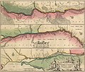
Fil:Tractus Bonysthenis, vulgo Dnieper.jpg

Storlek på förhandsvisningen: 703 × 600 pixlar. Andra upplösningar: 281 × 240 pixlar | 563 × 480 pixlar | 901 × 768 pixlar | 1 201 × 1 024 pixlar | 2 401 × 2 048 pixlar | 6 417 × 5 473 pixlar.
Originalfil (6 417 × 5 473 pixlar, filstorlek: 6,3 Mbyte, MIME-typ: image/jpeg)
Filhistorik
Klicka på ett datum/klockslag för att se filen som den såg ut då.
| Datum/Tid | Miniatyrbild | Dimensioner | Användare | Kommentar | |
|---|---|---|---|---|---|
| nuvarande | 2 mars 2022 kl. 14.47 |  | 6 417 × 5 473 (6,3 Mbyte) | DivadH | Uploaded a work by Jan Janssonius and Moses Pitt from Swedish National Archives, https://sok.riksarkivet.se/arkiv/52fknHVLV4gky2tQGB3526 with UploadWizard |
Filanvändning
Följande sida använder den här filen:
Global filanvändning
Följande andra wikier använder denna fil:
- Användande på outreach.wikimedia.org


