Fil:Svalbard ESA24544704.jpeg

Originalfil (17 264 × 17 264 pixlar, filstorlek: 49,59 Mbyte, MIME-typ: image/jpeg)
| Denna fil tillhandahålls av Wikimedia Commons. Informationen nedan är kopierad från dess filbeskrivningssida. |
Sammanfattning
| Varning | En del webbläsare kan ha problem med att visa denna bild i full upplösning: Denna bild har ett stort antal bildpunkter (pixlar) och kan antingen inte läsas in ordentligt eller få din webbläsare att låsa sig. | Interaktiv läsare för stora bilder |
|---|
| BeskrivningSvalbard ESA24544704.jpeg |
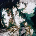
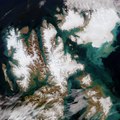
English: Extremely high temperatures recorded this summer caused record melting across Svalbard – one of the fastest warming places on the planet. The Copernicus Sentinel-2 mission captured this rare, cloud-free acquisition of the Norwegian archipelago in August 2022. Zoom in to see this image at its full resolution or click on the circles to learn more about the features in it. Located north of mainland Europe, Svalbard is around midway between the northern coast of Norway and the North Pole. The archipelago, which spans around 62 700 sq km, is composed of nine main islands. The largest is Spitsbergen, visible here in the far-left, followed by Nordaustlandet in the top-right and Edgeøya in the bottom-right. Spitsbergen, which is around the same size as Switzerland, has a mountainous terrain with most of the island covered with glaciers. Its highest point it Mount Newton, around 1717 m, in the northeast. The island is deeply indented by fjords. The longest fjord of the archipelago is Wijdefjorden and it is 108 km long. Opening on Spitsbergen's north coast, it runs roughly southwards into the interior, separating Andrée Land in the west from Margaretas Land in the east. Also on Spitsbergen lies the Svalbard Satellite Station – SvalSat for short – which can be seen in the image peeking through the clouds. The ground station, which is operated by Kongsberg Satellite Services (KSAT), has worked with a range of Earth observation missions including Aeolus, Swarm, CryoSat and all Copernicus Sentinel satellites. The station is also important to the Galileo satellite navigation system – Europe’s global navigation satellite system. Its location makes it one of the most remote Galileo ground stations in the world. This summer saw exceptionally warm air temperatures in Svalbard according to the Norwegian Meteorological Institute. An average of 7.4 °C was recorded in June, July and August compared to the 5.5°C average recorded during the 1991-2020 period. The heatwave caused exceptional levels of melting, which ultimately contributes to sea level rise. The image, captured on 21 August, shows the colourful and large sediment discharges in the Arctic Ocean. This is likely due to sediments that eroded by the flow of ice and then carried by meltwater into the Arctic Ocean. There is also some phytoplankton present in the waters, as seen in the far right, which colours the water turquoise and green. Data acquired by the Copernicus Sentinel satellites are used to detect changes in Earth's surface in great detail and monitor the effects of climate change on remote environments such as the Arctic region. This image is also featured on the Earth from Space video programme. |
| Datum | 28 oktober 2022 (uppladdningsdatum) |
| Källa | Svalbard |
| Skapare | European Space Agency |
| Andra versioner |
|
| Activity InfoField | Observing the Earth |
| Mission InfoField | Sentinel-2 |
| Set InfoField | Earth observation image of the week |
| System InfoField | Copernicus |
Licensiering

|
This image contains data from a satellite in the Copernicus Programme, such as Sentinel-1, Sentinel-2 or Sentinel-3. Attribution is required when using this image.
Erkännande: Contains modified Copernicus Sentinel data 2022
Attribution
The use of Copernicus Sentinel Data is regulated under EU law (Commission Delegated Regulation (EU) No 1159/2013 and Regulation (EU) No 377/2014). Relevant excerpts:
Free access shall be given to GMES dedicated data [...] made available through GMES dissemination platforms [...].
Access to GMES dedicated data [...] shall be given for the purpose of the following use in so far as it is lawful:
GMES dedicated data [...] may be used worldwide without limitations in time.
GMES dedicated data and GMES service information are provided to users without any express or implied warranty, including as regards quality and suitability for any purpose. |
Attribution
This media was created by the European Space Agency (ESA).
Where expressly so stated, images or videos are covered by the Creative Commons Attribution-ShareAlike 3.0 IGO (CC BY-SA 3.0 IGO) licence, ESA being an Intergovernmental Organisation (IGO), as defined by the CC BY-SA 3.0 IGO licence. The user is allowed under the terms and conditions of the CC BY-SA 3.0 IGO license to Reproduce, Distribute and Publicly Perform the ESA images and videos released under CC BY-SA 3.0 IGO licence and the Adaptations thereof, without further explicit permission being necessary, for as long as the user complies with the conditions and restrictions set forth in the CC BY-SA 3.0 IGO licence, these including that:
See the ESA Creative Commons copyright notice for complete information, and this article for additional details.
|
 | |
Denna fil har gjorts tillgänglig under licensen Creative Commons Erkännande-DelaLika 3.0 Mellanstatlig organisation. Erkännande: ESA, CC BY-SA IGO 3.0
| ||
Bildtexter
Objekt som porträtteras i den här filen
motiv
image/jpeg
Filhistorik
Klicka på ett datum/klockslag för att se filen som den såg ut då.
| Datum/Tid | Miniatyrbild | Dimensioner | Användare | Kommentar | |
|---|---|---|---|---|---|
| nuvarande | 28 oktober 2022 kl. 23.28 |  | 17 264 × 17 264 (49,59 Mbyte) | OptimusPrimeBot | #Spacemedia - Upload of https://www.esa.int/var/esa/storage/images/esa_multimedia/images/2022/10/svalbard/24544694-1-eng-GB/Svalbard.jpg via Commons:Spacemedia |
Filanvändning
Följande 2 sidor använder den här filen:
Global filanvändning
Följande andra wikier använder denna fil:
Metadata
Den här filen innehåller extrainformation som troligen lades till av en digitalkamera eller skanner när filen skapades. Om filen har modifierats kan det hända att vissa detaljer inte överensstämmer med den modifierade filen.
| Orientering | Normal |
|---|---|
| Upplösning i horisontalplan | 72 dpi |
| Vertikal upplösning | 72 dpi |
| Använd mjukvara | Adobe Photoshop 23.2 (Windows) |
| Ändringstidpunkt | 24 augusti 2022 kl. 12.14 |
| Färgrymd | Icke-kalibrerad |
| Datum och tidpunkt för digitalisering | 24 augusti 2022 kl. 13.26 |
| Datum metadata senast ändrades | 24 augusti 2022 kl. 14.14 |
| Unikt ID för originaldokumentet | xmp.did:6190d994-7d5b-2246-b22d-6ff25d703a1f |


